Project - Layout
Visual documentation of the colony's master plan and current state.
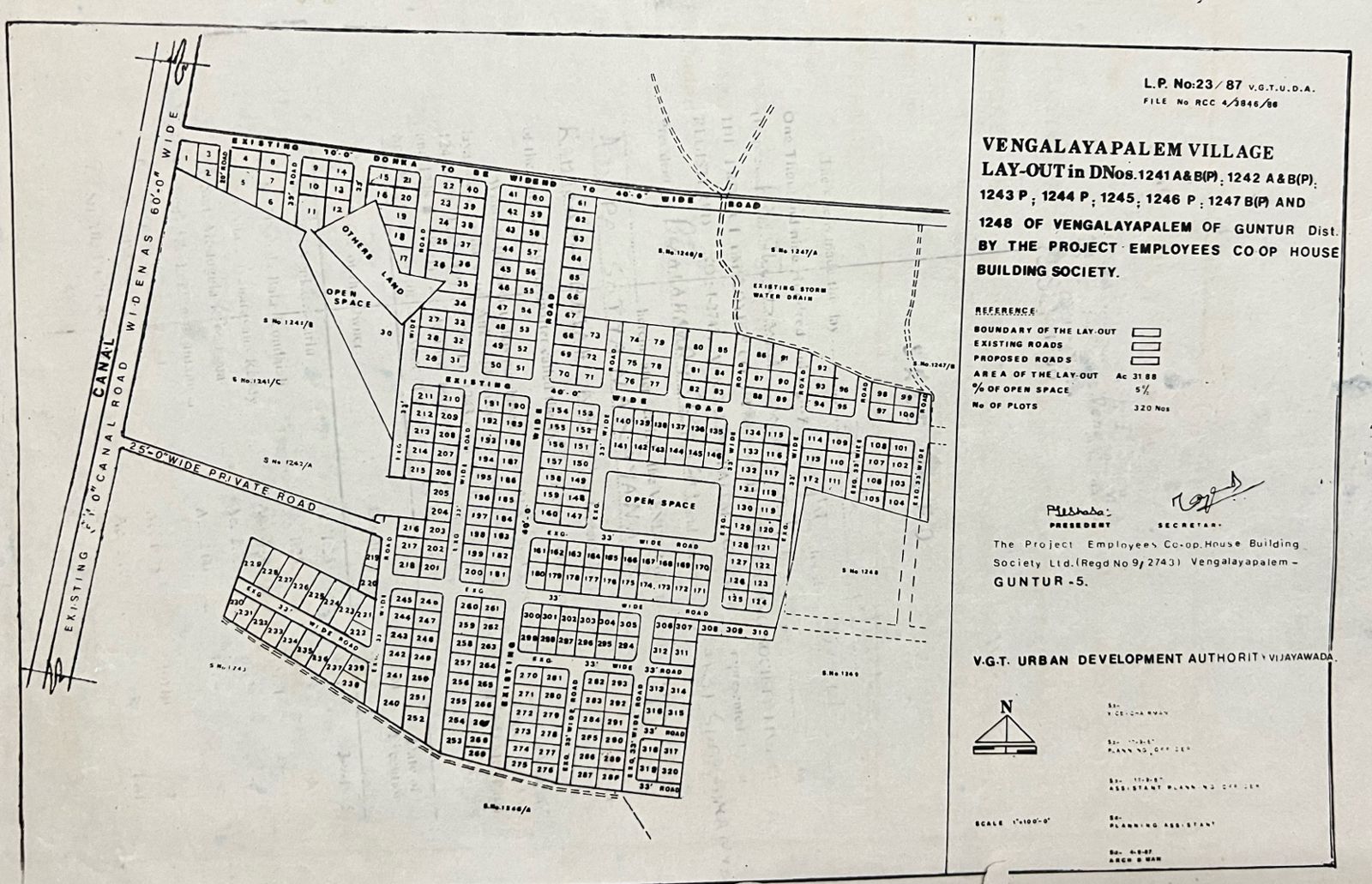
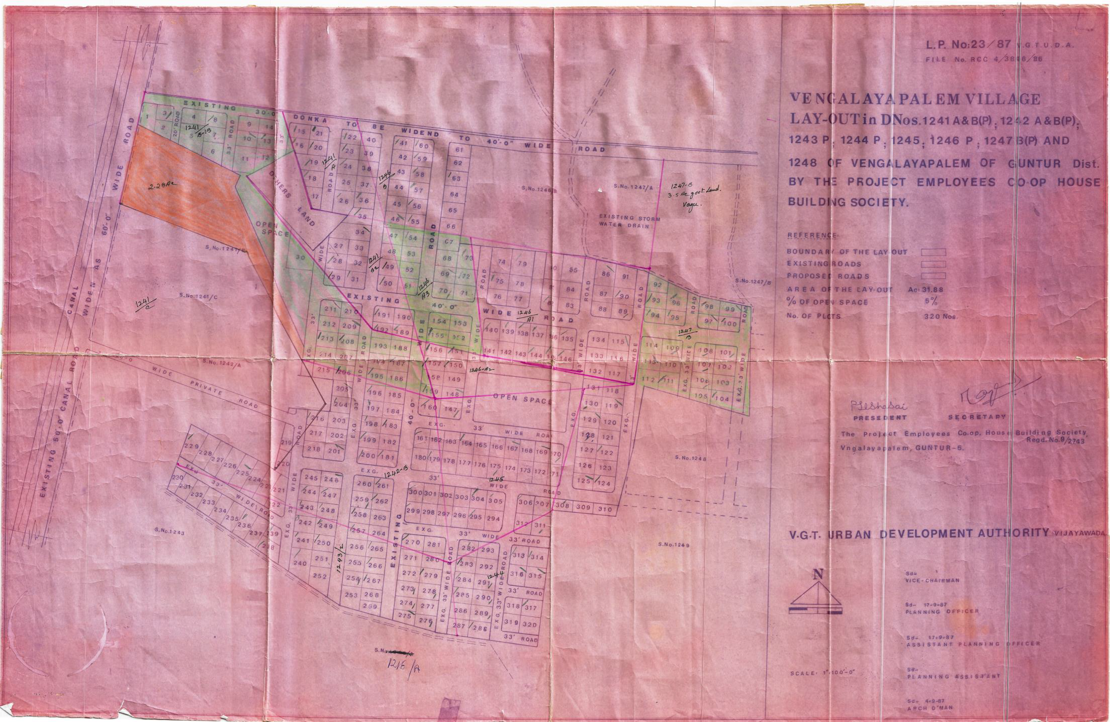
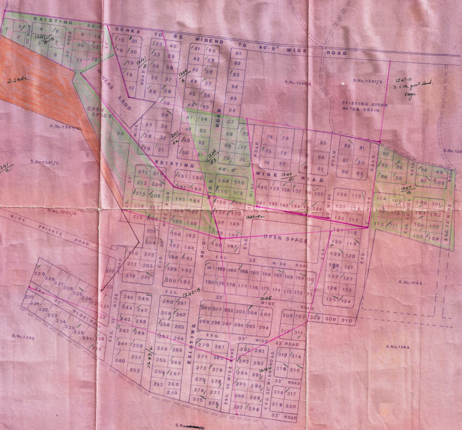
Official VGTUDA Approved Layout (1987)
The original master plan for Srisailam Colony, approved by the Vijayawada Guntur Tenali Urban Development Authority (L.P. No: 23/87).
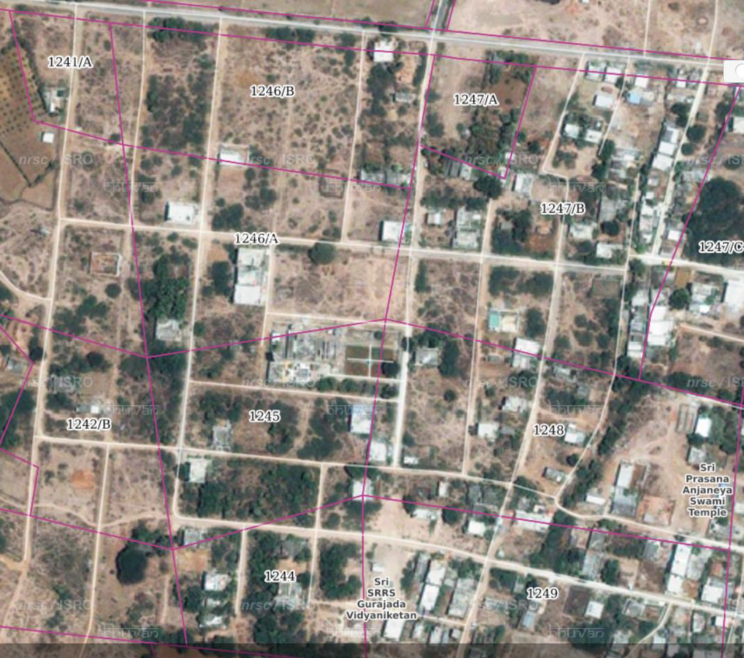
Aerial View of the Colony
A recent satellite image showing the current development and layout of Srisailam Colony and its surrounding areas.
Srisailam Colony LP 23/87 VGTUDA
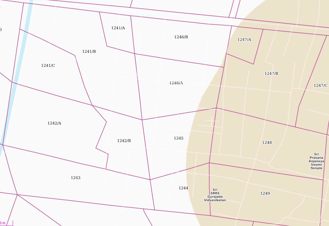
Survey Number wise Plots LP 23/87
1241 A & B(P), 1242 A & B(P), 1243 (P), 1244 (P), 1245, 1246 (P), 1247 B (P), 1248
Survey Number wise Map
(Source: Bhuvan ISRO)